

This is the first post in the travel section of the new blog! As Solutions Engineers and employees of SaaS companies, many of us find ourselves in Las Vegas at least once a year for corporate events like SKO (Sales Kick-Off), Oktane, or similar conferences. Instead of just taking the usual direct flight, why not seize the opportunity to explore some of America’s most iconic natural wonders?
This 2.5-day itinerary takes you from Phoenix to Las Vegas through Arizona’s natural wonders and some of the most spectacular landscapes in the United States, combining the mystical red rock formations of Sedona, the majesty of the Grand Canyon, and the nostalgic atmosphere of the legendary Route 66, turning a work trip into an unforgettable adventure.
The idea is to fly into Phoenix (PHX) instead of Las Vegas, and from there kick off a little road trip hitting Sedona, the Grand Canyon, and finally cruising Route 66 all the way to Las Vegas. This route is perfect for anyone who wants to maximize the travel experience, combining nature, culture, and American history in a single itinerary.
Trip Overview#
Route: Phoenix → Sedona → Grand Canyon → Route 66 → Las Vegas
Total distance: About 1000 km (620 miles)
Best time to go: Year-round, but watch out for winter conditions at the Grand Canyon
Itinerary#
- Day 1: Arrival in Phoenix and transfer to Sedona
- Day 2: Exploring Sedona and transfer to the Grand Canyon
- Day 3: Grand Canyon and Route 66 to Las Vegas
Map#
When to Go#
While this route is doable year-round, it has different characteristics depending on the season you choose.
Okta’s fiscal year starts in February, so our SKO usually happens between the second and fourth week of February. In 2025 I did this itinerary from February 15 to 17.
The Appeal and Advantages of Arizona in February#
February is an excellent time to visit Arizona for several reasons:
- Low tourist season: Fewer crowds at all the main attractions, letting you fully enjoy the views without excessive queues
- Ideal climate in the lowlands: Cool, pleasant temperatures in Sedona (15-20°C / 59-68°F during the day), perfect for hiking
- Full access to the Grand Canyon: During winter you can drive your own car inside the park, while in summer many roads are closed to private traffic
- Unique scenery: A snow-dusted Grand Canyon offers breathtaking views and extraordinary photo opportunities
Of course, there are some downsides too:
- Temperatures at higher elevations: The Grand Canyon (South Rim at 2,100m / 6,900ft elevation) can drop below freezing, with frequent snowfall that creates postcard-worthy landscapes but requires proper preparation
- Weather risks: Conditions can change rapidly. In our case, just two days before we arrived, the roads to the South Rim were closed due to heavy snow. It’s essential to:
- Monitor road conditions on Arizona DOT AZ 511
- Check the Grand Canyon webcams
- Seasonal closures: The Desert View Drive and some secondary Grand Canyon roads may be closed due to snow. Be ready to adapt and potentially modify the itinerary based on conditions.
Day 1: Phoenix → Sedona#
Arrival and Car Pickup#
We rented an Intermediate SUV through Avis, picking it up at Phoenix Airport and dropping it off at Las Vegas Airport, which turned out to be an excellent choice for navigating roads that were icy in some stretches.
Phoenix is a very efficient airport; baggage claim and car pickup were quick and hassle-free, allowing us to hit the road within an hour of landing.
Many companies, such as Avis, Hertz, Enterprise, allow you to do a “status match” with loyalty programs from other companies. This can get you free upgrades to more spacious or higher-category vehicles, perfect for a road trip like this. An elevated status (like Avis President’s Club or Hertz President Circle) can offer other perks like discounts or exclusive deals, but most importantly faster pickups, thanks to dedicated lanes and streamlined procedures.
Status matching often works with hotel loyalty programs too (like Marriott, Hilton, IHG), or with certain credit cards (like American Express Platinum), so if you already have status in a loyalty program, don’t forget to request a status match with the car rental company.
To drive in Arizona and Nevada, European citizens do not need an International Driving Permit (IDP), as long as the license uses Latin characters.
Transfer to Sedona#
Duration: About 2 hours
We decided not to linger in Phoenix and headed straight for Sedona to make the most of the afternoon exploring the red rock formations and the famous vortexes.

The drive from Phoenix to Sedona crosses desert landscapes that gradually give way to the iconic red sandstone formations. The most scenic route follows I-17 North to the exit for Highway 179.
Unfortunately, we hit a snag here: due to a major accident, Highway 179 was closed for over an hour. We were already on the road and had to wait for it to reopen, losing about 1 hour and 30 minutes.
The Arizona DOT AZ 511 site is essential for monitoring real-time road conditions, especially in winter.
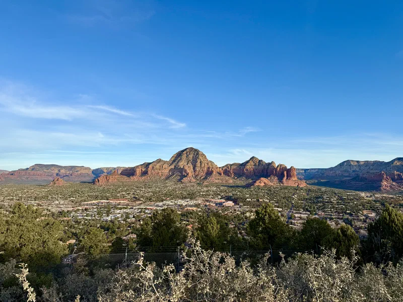
Visiting Sedona: The Essential Sites#
Sedona is famous for its vortexes, spots where an especially intense earth energy is said to be concentrated. According to local beliefs, these sites promote meditation, spiritual healing, and a deeper connection with nature. The four main vortexes are:
- Airport Mesa (masculine energy, yang)
- Bell Rock (balanced energy)
- Cathedral Rock (feminine energy, yin)
- Boynton Canyon (balanced energy)
- Sunset: 6:09 PM | Twilight: 6:35 PM
- Sunrise: 7:13 AM | First light: 6:47 AM
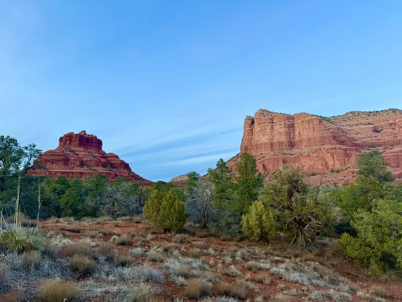
Bell Rock Vortex#
Parking: Bell Rock Trailhead Parking (free)
Bell Rock is one of Sedona’s most photographed rock formations and home to one of the famous energy “vortexes.” The formation resembles a giant bell and offers a moderately difficult trail. Even without tackling the full hike, the viewpoint from the parking area offers spectacular views.
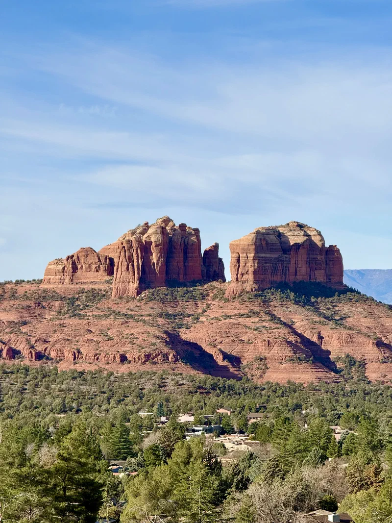
Cathedral Rock#
Parking: Cathedral Rock Trailhead Parking (free, but limited)
Cathedral Rock is probably the most iconic formation in Sedona. We admired it from several viewpoints, skipping the trail which is moderate-to-hard difficulty and requires using your hands in some sections, but for anyone interested in a more adventurous experience, the climb to the summit offers breathtaking panoramic views of the entire valley.
For those who prefer an easier walk, Red Rock Crossing (Crescent Moon Picnic Site, $11 entrance fee) offers the classic view of Cathedral Rock reflected in the waters of Oak Creek.
Cathedral Rock is visible from many spots around Sedona, so even if you don’t do the hike, you can admire it from various viewpoints around town.
Airport Mesa Vortex#
Parking: Airport Mesa Vortex Parking (free)
Perfect for sunset, Airport Mesa offers a 360° panoramic view of Sedona and its rock formations. The trail from the main road is short (10 minutes) and suitable for everyone.
Alternative: Sedona Airport Scenic Lookout (GPS: 34.8548, -111.7882) offers similar views with paid parking ($3).
Dinner and Overnight#
Sedona Airport, 1185 Airport Rd, Sedona, AZ
Located at Sedona’s small airport, this restaurant offers Southwest cuisine with panoramic views, perfect after catching the sunset from Airport Mesa since it’s just steps from the viewpoints.
We had a classic burger with fries – not the best I’ve ever had but satisfying, and above all with a spectacular view of the rock formations lit up by the sunset glow.
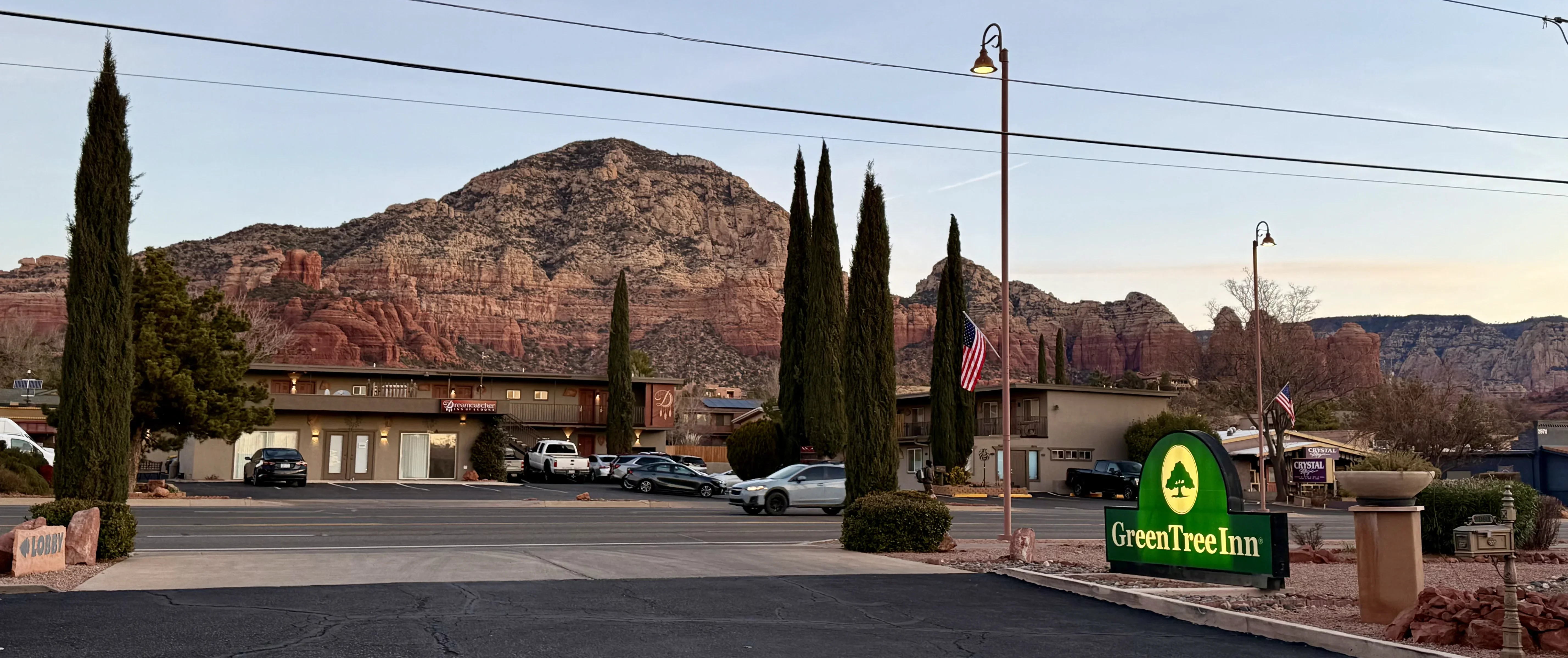
65 Arroyo Pinon Dr, Sedona, AZ 86336
For lodging we chose the GreenTree Inn Sedona for its strategic location just minutes from Sedona’s main points of interest, and for its excellent value for money. The property is simple but comfortable, with clean rooms, and breakfast (a bit basic) is included in the price.
Day 2: Sedona → Grand Canyon#
Morning in Sedona#
Early wake-up call: Given the time we lost the day before due to the Highway 179 accident, we decided to make the most of the morning in Sedona before heading to the Grand Canyon. Starting the day early to capture the soft morning light on the red rock formations is truly ideal for fully experiencing the magic of Sedona.
Airport Mesa (Revisited)#
Recommended time: 6:30-7:30 AM for sunrise light
Parking: Airport Mesa Vortex Parking (free)
If you visited Airport Mesa at sunset the day before, coming back at dawn offers a completely different perspective: the red rocks light up in warm tones as the sun rises, creating a magical and silent atmosphere.
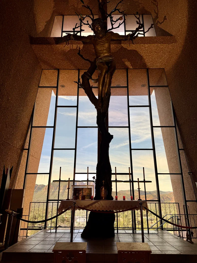
Chapel of the Holy Cross#
Opening hours: 9:00 AM-5:00 PM (Mon-Sat), 10:00 AM-5:00 PM (Sun)
Parking: Chapel of the Holy Cross Parking (free, but limited)
This Catholic chapel, conceived by Marguerite Brunswig Staude and completed in 1956, rises directly from the red rock at a height of 122 meters (400 feet). Its modernist architecture blends perfectly with the natural landscape, offering a space for contemplation with spectacular views of the valley below.
The Highway 179 delay from the previous day actually motivated us to explore Sedona more thoroughly before heading to the Grand Canyon, and it was absolutely worth it.
Sedona Photos#
Scenic Drive to the Grand Canyon (State Road 89A)#
Duration: 2.5 hours with stops
Recommended route: State Road 89A through Oak Creek Canyon
Alternative route: In case of snow/ice, use I-17 East toward Flagstaff (longer but safer)
The most scenic route follows State Road 89A through Oak Creek Canyon, a winding road that takes you from a red desert landscape into pine forests, with rock walls rising along the entire canyon. It’s one of the most spectacular stretches of the entire trip.
Must-See Stops Along the Way
Midgley Bridge#
Recommended time: 15-20 minutes
This arch bridge offers a breathtaking panoramic view of Oak Creek Canyon. There’s a small parking area on the right to pull over and snap photos of the canyon below.
Oak Creek Canyon Overlook#
Amenities: Rest area, artisan market (seasonal)
The ultimate photo spot on SR 89A, with a panoramic view over the entire valley. Here we were lucky enough to find a Navajo Native American market, where we bought some beautiful handcrafted necklaces. If you’re passing through, it’s worth a look.
You can also see some of the switchbacks of the 89A winding along the rock walls, creating a postcard-worthy landscape.
Grand Canyon South Rim: Entering from Desert View#
Cost: $35 per vehicle (valid 7 days) - rates as of February 2025
Hours: 24/7 (the entrance is always open, but some services close at night)
Coming from Sedona via Flagstaff, the strategic entrance is Desert View (East Entrance), which lets you avoid the crowds at the main Visitor Center and offers a more gradual and scenic introduction to the canyon.
While it’s a less-traveled route compared to the classic approach from Tusayan (South Entrance), driving the Desert View Drive (SR 64) from east to west transforms your arrival at the Grand Canyon into an emotional crescendo: the landscape changes gradually, the views become more and more spectacular, and each viewpoint reveals a new perspective of the canyon.
Desert View Drive#
Summer access: Private car allowed
Length: 25 miles / 40 km
Recommended time: 2-3 hours with stops
Before reaching the hotel, we spent the afternoon exploring Desert View Drive, which connects the east entrance to Grand Canyon Village. This 25-mile scenic road offers some of the most spectacular viewpoints on the South Rim, each with its own unique character.
Desert View Drive can be driven in both directions, but starting from the east (Desert View) heading west (Village) puts the sun behind you for afternoon photography. Plan 3-4 hours for the main stops.
Here are the Essential Viewpoints (from east to west).
Desert View Watchtower#
Features: Historic 1932 tower designed by Mary Colter, 70 steps
View: 360° over canyon and desert, Colorado River visible
This iconic stone tower, standing 21 meters (70 feet) tall, is inspired by the watchtowers of the Ancestral Puebloans. The 70-step climb leads to an observation platform offering spectacular views from the Colorado River to the mountains of Utah. Inside, Native American murals decorate the walls.
You’ll also find a small souvenir shop and a refreshment spot, the Desert View Market & Deli, great if you want to grab a quick snack.
Navajo Point#
Elevation: 2,267 m / 7,438 ft (highest point on the South Rim)
View: Bird’s-eye perspective over the entire canyon
From the highest point on the South Rim you get an unmatched view: the canyon stretches in every direction, and on clear days visibility can reach over 160 km (100 miles).
Lipan Point#
View: Panoramic view of the Colorado River
One of the widest views on the South Rim, Lipan Point lets you watch the Colorado River winding in the distance. The afternoon light creates dramatic contrasts between the geological layers.
Moran Point#
View: Excellent for photography and geology
This viewpoint, named after the painter whose works helped make the Grand Canyon a national park, offers a perfect vantage point for understanding the canyon’s geological layers.
Grandview Point#
View: Panoramic view of the South Rim
History: Starting point of early mining expeditions
Trail: Grandview Trail (difficult, 6.4 km / 4 mi round trip)
One of the widest panoramas on the South Rim, Grandview Point is also the access point for the Grandview Trail, one of the steepest historic trails in the canyon (experienced hikers only).
Mather Point#
View: Iconic view of the central canyon
Amenities: Visitor Center, ample parking, restaurants
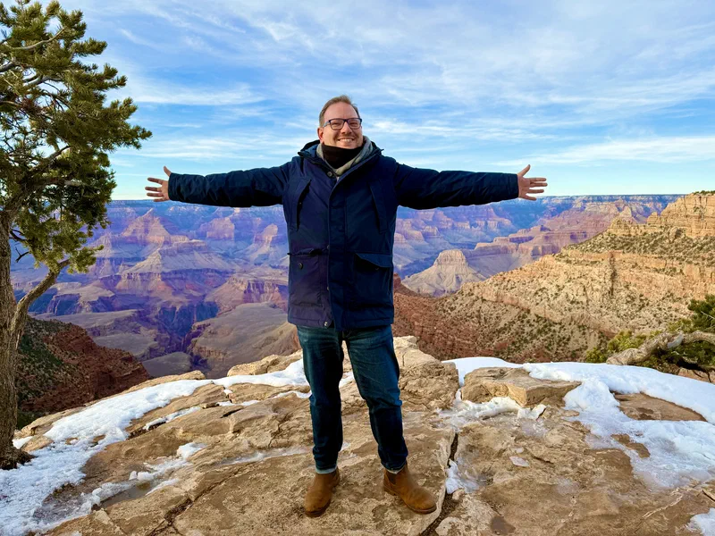
We stopped here to watch the sunset.
- Sunset: 6:10 PM | Evening Twilight: 6:36 PM
- Sunrise: 7:15 AM | Morning Twilight: 6:49 AM
Dinner and Overnight#
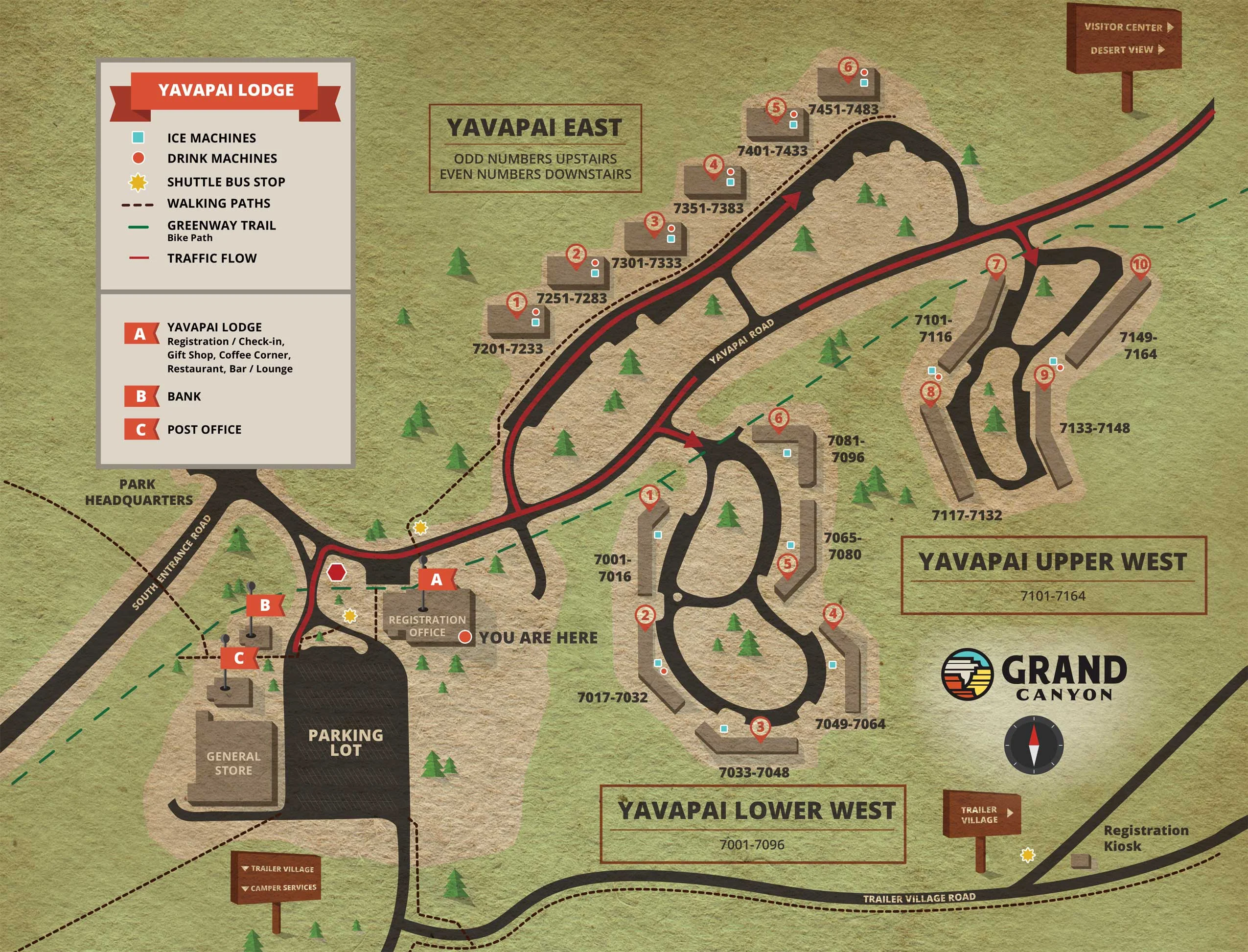
11 Yavapai Lodge Road, Grand Canyon Village, AZ 86023
As usual, restaurants in national parks aren’t exactly known for their cuisine, but the Yavapai Tavern offers a simple menu (American fare like burgers, sandwiches, Tex-Mex specialties - here’s the menu), perfect for a relaxed, no-frills dinner after an intense day.
It also has the advantage of being inside the lodge, steps from the rooms, so you can enjoy the sunset and then head back comfortably without getting back in the car.
We also used it for breakfast the next morning, with a basic menu (eggs, pancakes, toast).
Staying inside the park is a unique experience: you can reach the viewpoints on foot and enjoy the canyon without the long queues at the entrances. The Yavapai Lodge offers the best value for money among the park’s accommodations. The rooms are simple but comfortable, and the location is unbeatable for exploring the South Rim, just a short walk from Mather Point.
Accommodations inside the Grand Canyon are limited and in high demand, especially during peak season. For February you can usually find availability a few months ahead, but it’s always best to book as early as possible.
The Lodge is made up of several buildings scattered among the trees, with rooms overlooking an inner courtyard. Don’t expect luxury, but it’s perfect for anyone who wants to experience the park without spending a fortune.
The “Lower West” area is the closest to Mather Point, the reception, and the restaurant. If you want a quieter room, ask for one in the “East” area, which is farther from foot traffic and common areas.
The Grand Canyon is certified as an International Dark Sky Park, with some of the darkest, most star-filled skies in the continental United States. On a clear February night, the Milky Way is clearly visible to the naked eye and it’s an absolutely stunning sight.
After dinner, treat yourself to an unforgettable experience: grab a flashlight, bundle up, and walk a bit away from the hotel lights to gaze at the sky.
Day 3: Grand Canyon → Las Vegas#
Sunrise at Mather Point#
Getting up early to watch the sunrise over the Grand Canyon is an experience that more than justifies the early alarm. The dawn light transforms the canyon: the walls shift from deep purple to intense orange, creating a play of shadows and colors that changes minute by minute. The temperature is below freezing, but the spectacle makes every shiver worth it, and personally, I preferred the sunrise colors to the sunset!
We chose to watch the sunrise from Mather Point, given its proximity to the Yavapai Lodge and easy access. Despite being the most popular spot, it offers a spectacular view of the entire central canyon. The easy access makes it ideal if the temperature is particularly harsh and you want to minimize time outdoors.
There are other spots along Desert View Drive that offer equally spectacular (and less crowded) sunrise experiences, such as Yaki Point (a more intimate, east-facing perspective, perfect for sunrise) and Navajo Point (along Desert View Drive).
Mather Point is also the most logical choice for starting to explore the western part of the South Rim, after having driven Desert View Drive from east to west the previous day.
Hermit Road#
Summer access: Free shuttle bus only (March-November)
Length: 7 miles / 11 km, 9 viewpoints
Recommended time: 2-3 hours with stops
One of the great advantages of visiting the Grand Canyon in winter is being able to drive your own car along Hermit Road, which is normally accessible only by shuttle bus during the other months. This 7-mile scenic road offers unique views and the best sunset spots on the South Rim: one more reason to consider a second night in the park, if time allows.
Here are the Must-See Viewpoints on the western part of the South Rim, along Hermit Road (from east to west).
We hit them all, and if I had to recommend just one it would definitely be Hopi Point, but each viewpoint has its own charm and deserves a stop if you have the time.
Hopi Point#
Best for: Sunset (considered the #1 spot)
View: 360° with a perspective of the sun disappearing behind the canyon walls
Universally recognized as the best spot for watching the sunset at the Grand Canyon. The position jutting out into the canyon offers a panoramic view that lets you watch the sun sink behind the rock formations, painting the walls in red and orange.
Mohave Point#
View: Direct view of the Colorado River rapids, visible for 3 miles
One of the few points where the Colorado River is clearly visible. The angle lets you observe the river winding through the inner gorges of the canyon.
Powell Point#
Ideal for: Sunset and sunrise
Monument: Memorial dedicated to John Wesley Powell
An excellent alternative to Hopi Point, slightly less crowded but with equally spectacular panoramas. Here you’ll find the monument dedicated to John Wesley Powell, the first explorer to navigate the Colorado River through the Grand Canyon in 1869.
Pima Point#
Features: Less crowded, contemplative atmosphere
View: Western perspective of the canyon
The last viewpoint along Hermit Road offers a quieter, more introspective experience. The view extends westward, perfect for anyone seeking a moment of contemplation away from the crowds.
Grand Canyon Maps and Trails#
On the official park website Grand Canyon Maps & Publications you can download detailed maps of trails, scenic roads, and viewpoints, essential for planning your visit and navigating the park.
Given our limited time we didn’t venture onto the trails, but if you have more time, easy hikes like the Rim Trail (from Mather Point to Hermits Rest) or the initial stretch of the Bright Angel Trail (to the 1.5 Mile Resthouse) are perfect for anyone who wants to immerse themselves a bit more in nature without tackling overly demanding routes. I’ve added them to my TO DO list for next time!
Also download the National Park Service Mobile App for offline maps, information, and real-time updates on park conditions.
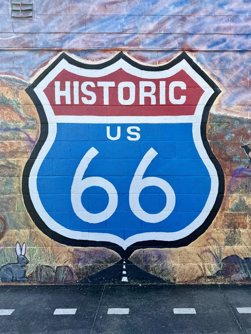
Route 66 Historic Drive: On the “Mother Road”#
Duration: 5-6 hours with stops
Departure from Grand Canyon: 10:30/11:00 AM
Route: Grand Canyon → Williams → Seligman → Peach Springs → Kingman → Las Vegas
Arrival in Las Vegas: Around 8:00 PM
After the first morning at the Grand Canyon, it’s time to hit the legendary Route 66, the “Mother Road” that defined the American concept of road trips and four-wheeled freedom. Inaugurated in 1926 and in service until 1985, when it was replaced by the Interstate system, Route 66 connected Chicago to Los Angeles through the heart of America.
The Arizona stretch is one of the best preserved, with towns that have maintained the authentic atmosphere of the ’50s and ’60s. The route crosses desert landscapes, rural communities, and vintage memorabilia that tell the story of a golden age of American tourism.
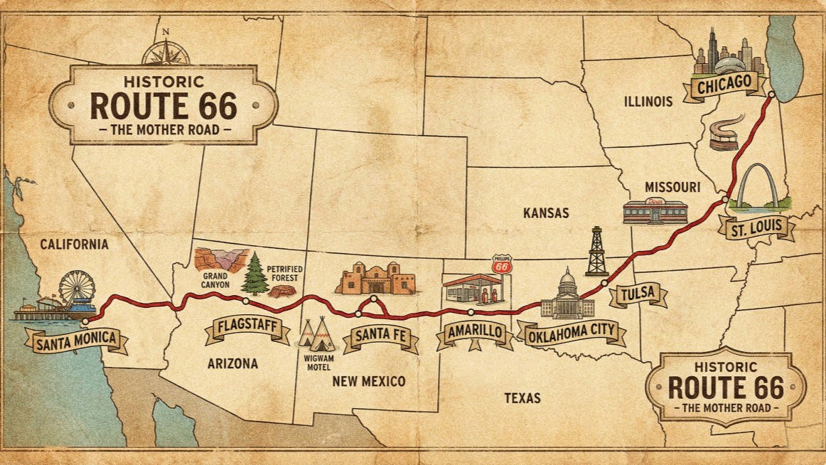
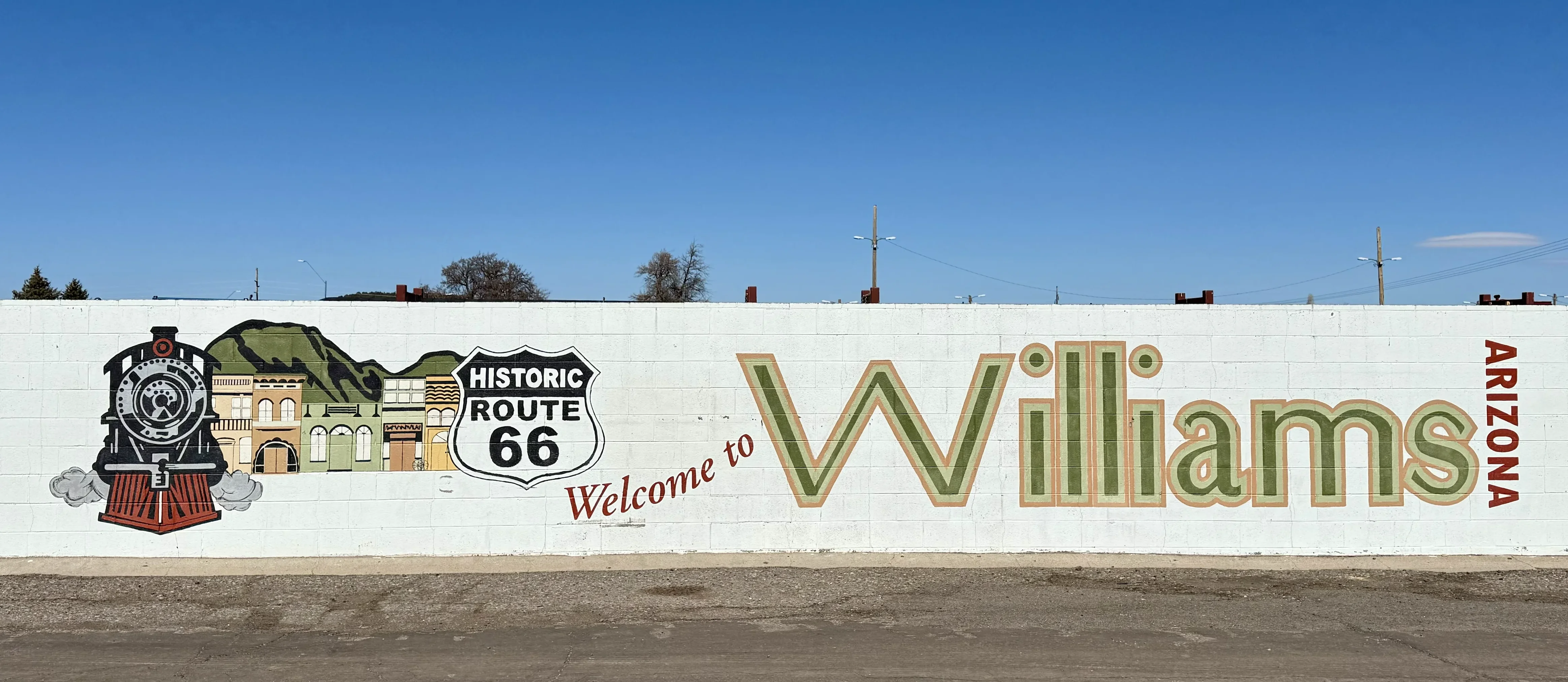
Williams: “Gateway to the Grand Canyon”#
Duration: 1 hour
Recommended visit time: 1 hour + lunch
Estimated arrival: 11:45 AM
The first stop is Williams, located right at the end of Route 64 that connects the South entrance of the Grand Canyon.
Williams holds a historic distinction: it was the last town on Route 66 to be bypassed by Interstate 40 in 1984, holding out until the very end before the freeway era replaced the Mother Road. This spirit of resistance has preserved an authentic ’50s atmosphere, with a paved Main Street, vintage neon signs, and perfectly preserved classic diners.
The town calls itself the “Gateway to the Grand Canyon” thanks to the historic railroad connecting Williams to the South Rim, still in operation for tourists.
What to See in Williams on Route 66#
Main Street (Historic Route 66)
Stroll along Main Street to soak in the ’50s Route 66 atmosphere: colorful murals, vintage gas stations, retro neon signs, and souvenir shops selling license plates, posters, and authentic memorabilia.
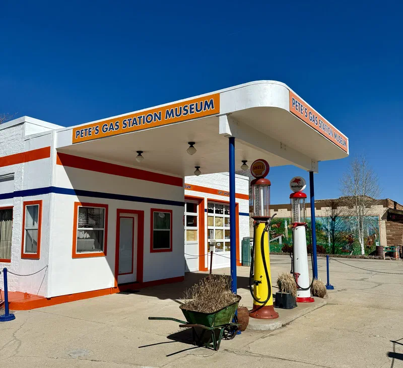
101 E Rte 66, Williams, AZ 86046, États-Unis
A former gas station turned Route 66 museum, with a collection of vintage gas pumps, neon signs, and memorabilia that tell the story of the evolution of road travel in America.
233 N Grand Canyon Blvd, Williams, AZ 86046
A historic but still functioning train station, from which trains depart for the Grand Canyon, with a small museum dedicated to railroad history.
Where to Eat in Williams#
137 W Railroad Ave, Williams, AZ 86046
A historic restaurant with a classic American menu, famous for its pancakes and burgers. We stopped here for an excellent burger at a very reasonable price ($13.50 for a cheeseburger with fries) before heading to Seligman.
Other recommended restaurants in Williams:
- Red Raven Restaurant: American cuisine with a gourmet twist, great for a more substantial lunch
- Cruisers Route 66 Cafe: ’50s-style diner with a classic menu and vintage atmosphere
- Pine Country Restaurant: Grilled meat specialties
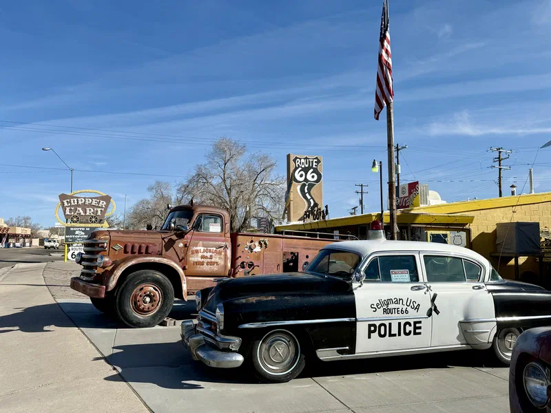
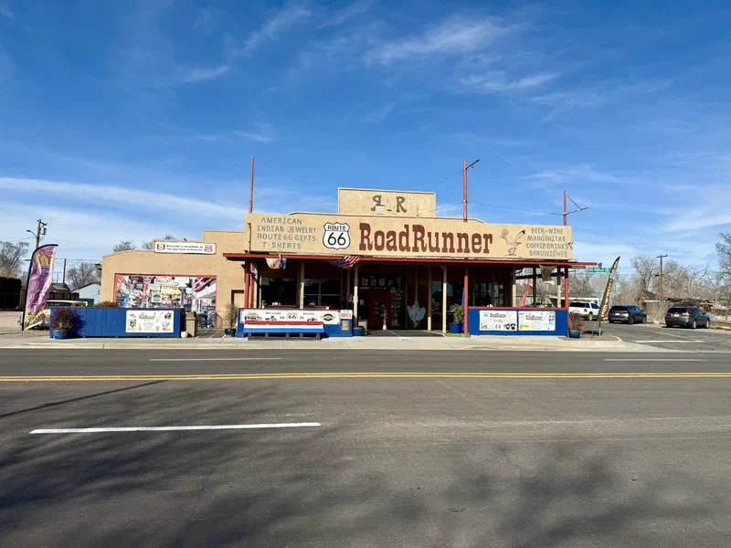
Seligman: “Birthplace of Historic Route 66”#
Duration: 40 minutes
Recommended visit time: 1-1.5 hours
Estimated arrival: 3:00 PM
Seligman holds a special place in Route 66 history: it’s the cradle of the preservation movement for the historic road, thanks to the tireless efforts of the Delgadillo family.
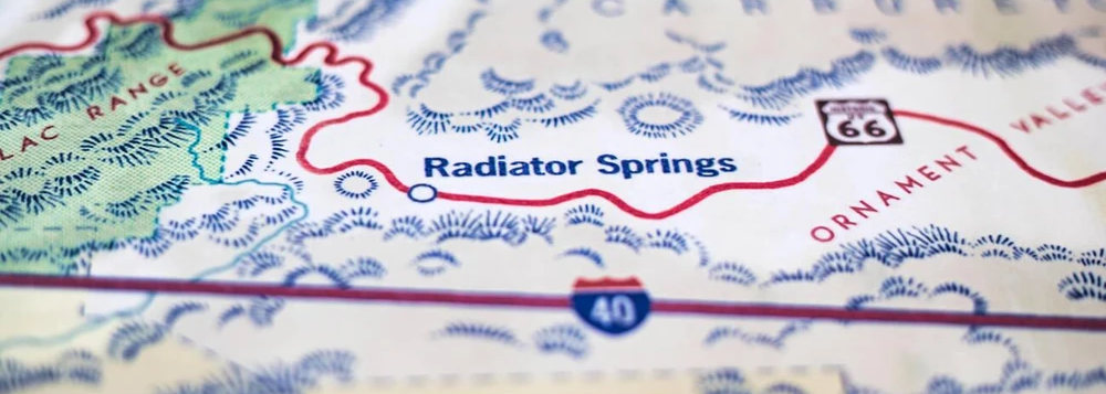
The town inspired Radiator Springs in the Disney/Pixar film “Cars”, and walking down Main Street you can’t help but recognize the references: the vintage atmosphere, the colorful characters, the quirky shops. Seligman is a trip back in time, a living museum of American road culture.
What to See in Seligman, the Town that Inspired Cars#
22265 Historic Rte 66, Seligman, AZ 86337
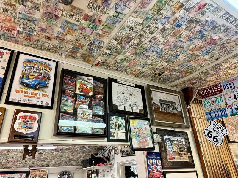
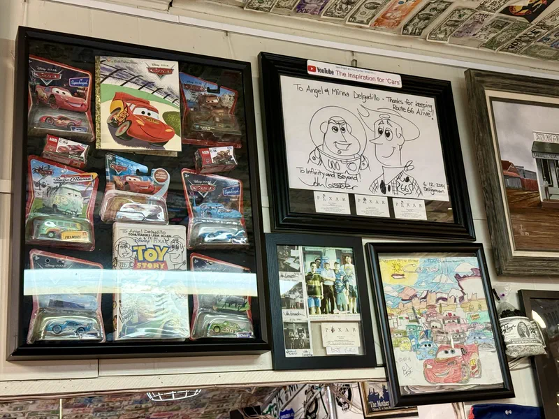
This iconic yellow and blue shop, run by the Delgadillo family, is an institution. Angel Delgadillo, the barber-activist who in the ’80s saved Route 66 from permanent closure by founding the Historic Route 66 Association, transformed his barbershop into a living museum packed with memorabilia, historic photographs, and fascinating stories. If you’re lucky, you might meet family members who share anecdotes about the battle to preserve the road.
Inside you’ll also find posters autographed by John Lasseter, who interviewed Angel to capture the essence of Route 66 for the film Cars. Some people think the character of Ramone was inspired by him, with his colorful shop and passion for vintage cars.
22405 Historic Rte 66, Seligman, AZ 86337
Another shop run by the Delgadillo family, with a collection of memorabilia and a unique atmosphere. The nearby Snow Cap Drive-In, with its quirky menu and costumed waiters, is a must for a quick bite or ice cream.


Peach Springs: Hualapai Territory#
Duration: 40 minutes
Recommended visit time: 20 minutes
Estimated arrival: 4:45 PM
Peach Springs sits in the heart of the Hualapai reservation and offers an interesting perspective on Native American culture.
To be honest, it’s not an unmissable stop, but if you have the time and are interested in Native culture, it’s worth pulling over for a meal or a quick visit.
Even though the name and location might make you think this is the “Radiator Springs” from Cars, the model is actually a mix of several towns along Route 66, including Seligman, which we talked about earlier, but also others like Amboy in California. If you have to pick one Cars-style town on this route, Seligman is definitely the most iconic and the one that most inspired the film.
What to See in Peach Springs#
900 AZ-66, Peach Springs, AZ 86434
Hotel and cultural center with exhibits on the history of the Hualapai people.
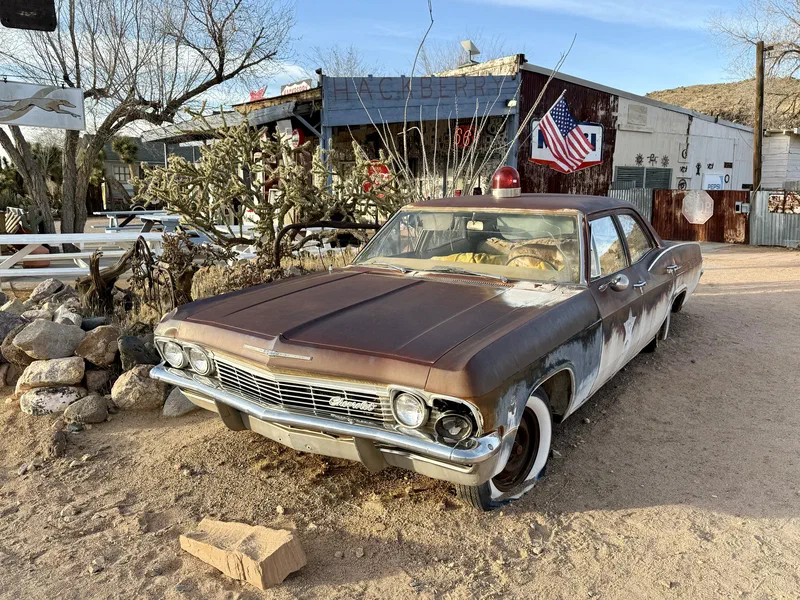
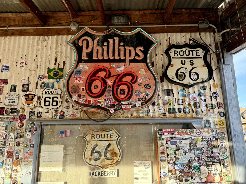
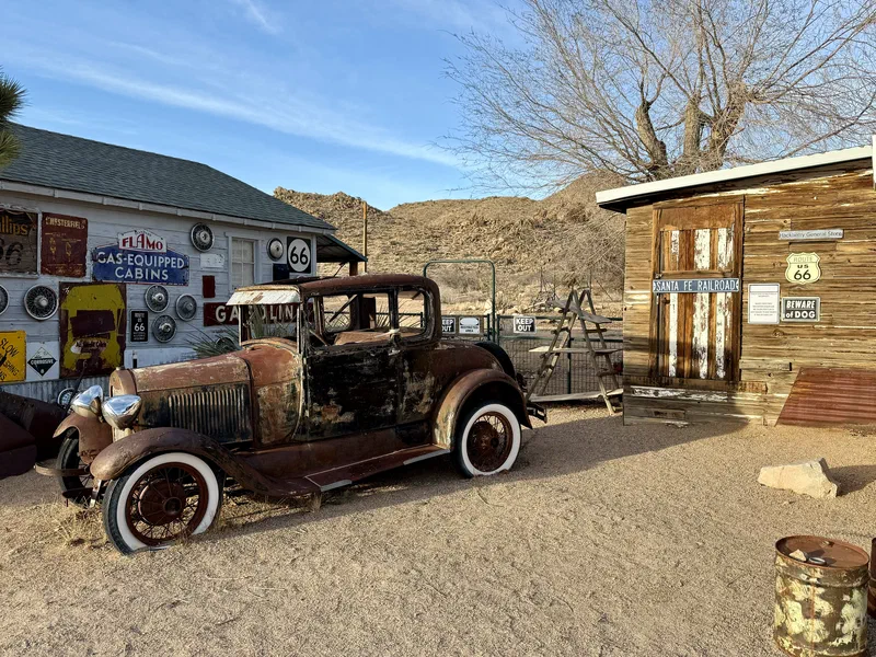
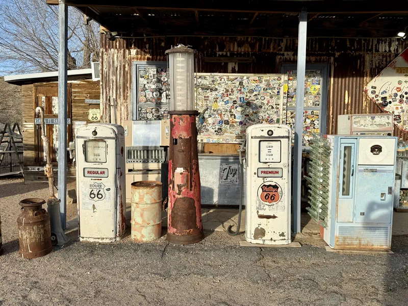
Hackberry General Store#
Duration: 25 minutes
Recommended visit time: 30 minutes
Estimated arrival: 5:30 PM
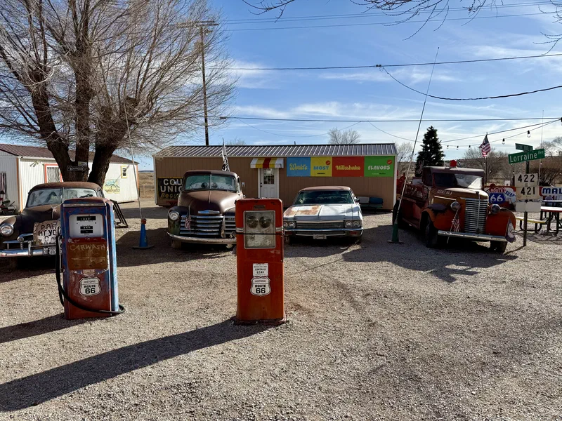
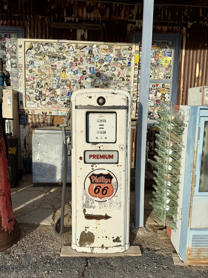
Just before reaching Kingman, in the middle of the desert nowhere, you’ll come across the Hackberry General Store, a general store turned Route 66 museum with an impressive collection of vintage cars – an unmissable photo stop.


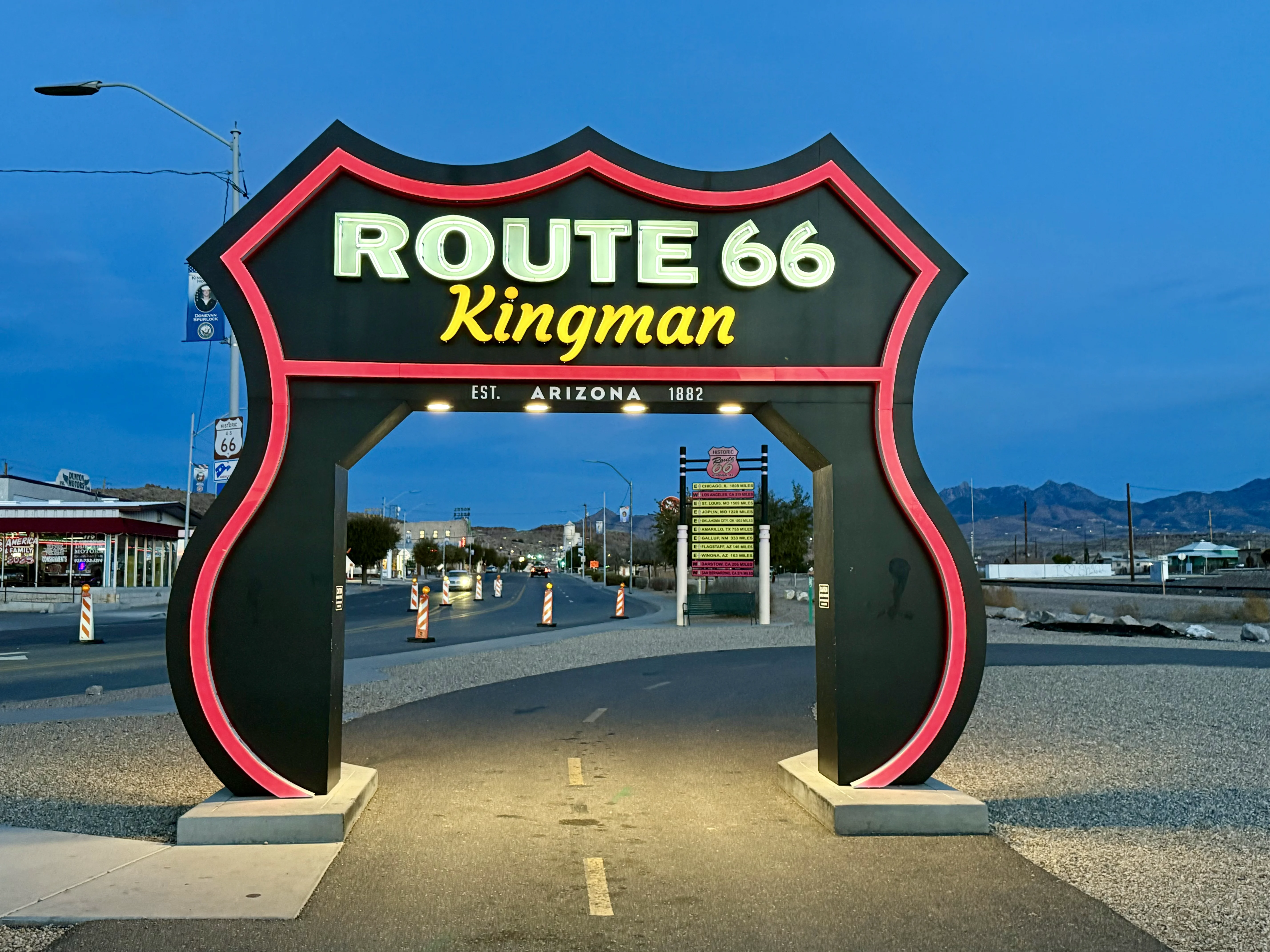
Kingman: “Heart of Historic Route 66”#
Duration: 30 minutes
Recommended visit time: 1 hour
Estimated arrival: 6:00 PM
Kingman was one of the most important cities on Route 66 and houses the best museum dedicated to the road. It’s also the last major town before the turnoff to Las Vegas, making it a great place for a stop before reaching your final destination.
Following this route, you’ll arrive around sunset, with the city lights coming on, creating a perfect atmosphere to wrap up your Route 66 journey. There isn’t much time left for sightseeing, but it’s still worth stopping to snap some photos of the giant signs celebrating the road’s history.
If you’d rather spend more time visiting Kingman, you could consider skipping the Peach Springs stop or reducing your time in Seligman, or simply leaving the Grand Canyon earlier.
What to See in Kingman#
120 W Andy Devine Ave, Kingman, AZ
Interactive exhibits on the history of Route 66, vintage cars, and traveler memorabilia. When we arrived the museum was already closed, but we were able to visit the adjacent souvenir shop, which offers a wide range of vintage items and Route 66 memorabilia.
120 W Andy Devine Ave, Kingman, AZ
A ’50s-style diner with a classic American menu. It’s said to be the most photographed diner on Route 66. We didn’t stop for dinner but headed straight for Las Vegas, but it could be a great idea to grab a meal here before continuing.
Arrival in Las Vegas#
Duration: 1h 50min
Estimated arrival: 8:00 PM
The contrast between the historic Route 66 villages and the glittering lights of Las Vegas makes for the perfect finale to this journey through authentic America.
The road from Kingman to Las Vegas crosses the Mojave Desert, with landscapes shifting from arid to mountainous. Arriving in Las Vegas at sunset, with the city lights switching on, is a magical experience. The road descends toward the city, offering a spectacular view of the Las Vegas skyline, which puts on its best show at night.
If you have an extra day in Las Vegas, consider keeping the car to visit:
- Red Rock Canyon: 30 minutes from downtown Las Vegas, spectacular desert views
- Valley of Fire State Park: 1 hour drive, stunning red rock formations
- Grand Canyon West Rim (Skywalk): Helicopter tours with companies like Maverick or Papillon
I’ll write dedicated articles about these destinations in the future.
Practical Tips#
What to Pack in Winter#
- Layered clothing: Temperatures vary from 20°C / 68°F (Phoenix) to -5°C / 23°F (Grand Canyon)
- Hiking shoes: If you want to venture onto the trails in Sedona or the Grand Canyon
- Snow chains or winter tires: Recommended for the Grand Canyon (often mandatory)
- Car emergency kit: Blankets, water, energy snacks
- Flashlight: Especially if you want to take advantage of the starry nights at the Grand Canyon
- Offline maps: For navigating areas with poor cell coverage (Google Maps, Apple Maps)
Useful Links#
- Road conditions: Arizona DOT AZ 511
- Sedona: VisitSedona.com
- Grand Canyon National Park: NPS Grand Canyon
- Grand Canyon Weather: National Park Service Weather
- Grand Canyon Webcams: Live Canyon Views
- Route 66 Information:
Recommended Apps#
- NPS Grand Canyon: Official park app
- Route 66 Navigator: For discovering attractions along the road
- Google Maps: Download offline maps for areas with poor coverage
- Mobile Passport Control (MPC): To speed up the entry process into the United States if you’re arriving by plane with a valid ESTA
Cost Summary#
Estimates based on February 2025, for 2 people with 1 vehicle.
| Item | Estimated Cost | |
|---|---|---|
| 🚗 | Intermediate SUV rental, 3 days, one-way PHX → LAS | $200 – $250 |
| 🚗 | Fuel (~620 miles) | ~$90 |
| 🎟️ | Grand Canyon (per vehicle, valid 7 days) | $35 |
| 🎟️ | Red Rock Crossing, Sedona (optional) | $11 |
| 🏨 | GreenTree Inn Sedona (1 night, breakfast included) | $80 – $130 |
| 🏨 | Yavapai Lodge, Grand Canyon (1 night) | $120 – $180 |
| 🍔 | Dinner Day 1 – Mesa Grill Sedona | $50 – $70 |
| 🍔 | Dinner Day 2 – Yavapai Tavern | $40 – $60 |
| 🍔 | Breakfast Day 3 – Yavapai Tavern | $20 – $30 |
| 🍔 | Lunch Day 3 – Annas Canyon Cafe, Williams | $30 – $40 |
| Total for 2 people | ~$676 – $896 | |
| Per person | ~$340 – $450 |
If you have other national parks planned on the same trip, consider the America the Beautiful Pass ($80/year).
Conclusions#
This itinerary turns a simple work trip into a unique experience, with a perfect balance of natural wonders and American cultural heritage. The combination of Sedona, Grand Canyon, and Route 66 offers different but complementary experiences: from the spirituality of the vortexes to the breathtaking canyon views, to the nostalgia of America’s most famous road.
February, despite the weather challenges, remains an ideal time for this trip: fewer tourists, lower prices, and unique winter landscapes. With proper preparation and flexibility for potential route changes due to weather, this road trip will become an unforgettable memory.
The magic of Arizona isn’t just in its iconic landscapes, but in the sense of freedom you feel driving through these infinite spaces, where every curve reveals a new wonder and every mile tells a story of America.
My Top 5 Moments#
- Sedona — A true revelation. The rock formations, the vortexes, the atmosphere… I’d go back in a heartbeat to spend a few days there! Day 1: Sedona
- State Road 89A — One of the most beautiful roads I’ve ever driven. The Oak Creek Canyon stretch is absolutely breathtaking. The scenic drive
- Sunrise at Mather Point — I preferred the sunrise to the more popular sunset. The colors are incomparable. Sunrise at Mather Point
- Seligman — You can truly feel the spirit of Route 66. The town that inspired Cars is worth the stop. Seligman
- The desert road from Peach Springs to Hackberry — Miles of absolute nothingness without a soul in sight. Off-season at its finest. Hackberry General Store
What about you?#
Have you tried this itinerary? Got any questions or requests? Drop me a line in the comments